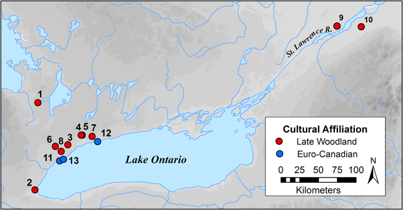
Figure 1. Map showing locations of archaeological sites.
1 – Steven Patrick, 2 – Skyway, 3 –Robb, 4 – Joseph Picard, 5 – Yatsihsta’, 6 – Bathurst St., 7 – Grandview, 8 – Moatfield, 9 – Summerstown Station, 10 – Mailhot-Curran, 11 – Bishop’s Block, 12 – Trull, 13 – Ashbridge. For cultural affiliation, Late Woodland includes Iroquoian sites dating from approx. AD 1300–1550, and Euro-Canadian includes historical European settlement sites dating from approx. AD 1790–1900. Data from Grandview and Moatfield are from published literature53. Figure created by AH using ArcGIS Desktop, Release 10 (www.esri.com).

