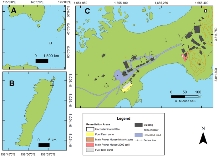
Figure 1.
Location of (A) Macquarie Island in the Southern Ocean, (B) the ANARE research station at the Northern tip of the island and (C) the research station layout. The yellow, red and orange sites on the map indicate the contaminated sites currently undergoing remediation. The uncontaminated sampling site is indicated by the white rectangle outlined in black. Station buildings are shown by black rectangles. This map was created in ArcGIS Version 10.3 https://esriaustralia.com.au/products-arcgis-software-10-3.

