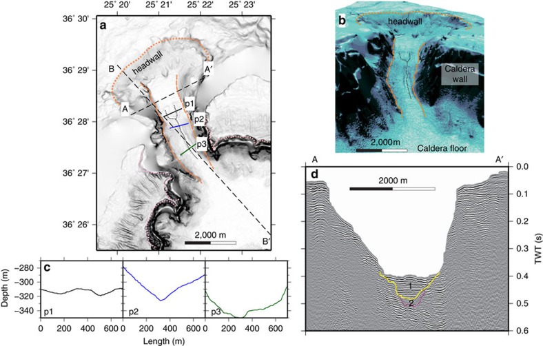
Figure 2. More detailed topography and seismic profiling of the NW strait of Santorini caldera.
(a) Shaded slope gradient with the location of profiles shown in 2c (p1, p2 and p3), 2d (seismic profile A-A′) and Fig. 3 (seismic profile B-B′) marked. The dotted orange line marks the location of the erosional headwall, the dashed orange line the channel sides, the dotted pink line the rim of the caldera, and the dotted black line the small-scale drainages superimposed on the large-scale channel. (b) Perspective view of the NW strait. (c) Bathymetric cross sections perpendicular to the NW strait. (d) Seismic profile perpendicular to the strait axis, showing caldera-fill stratigraphic units 1 and 2 of ref. 10.

