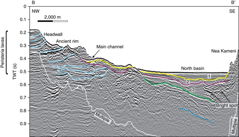
Figure 3. Interpreted multi-channel reflection seismic profile along the axis of the NW strait.
Transect B-B′ in Fig. 2. Stratigraphic units 1–3 of ref. 10 are shown numbered. The light blue lines indicate stratigraphic horizons within Peristeria lavas, and the dotted dark blue line indicates the presence of a deep, but poorly defined reflector. What appears as an edifice in the upper part of the slope is a ledge of the channel rim. A TWT (two-way travel time) interval of 0.1 s corresponds approximately to a water depth interval of 75 m or a sediment interval of 100 m. Please refer to Supplementary Fig. 1 for the uninterpreted seismic profile.

