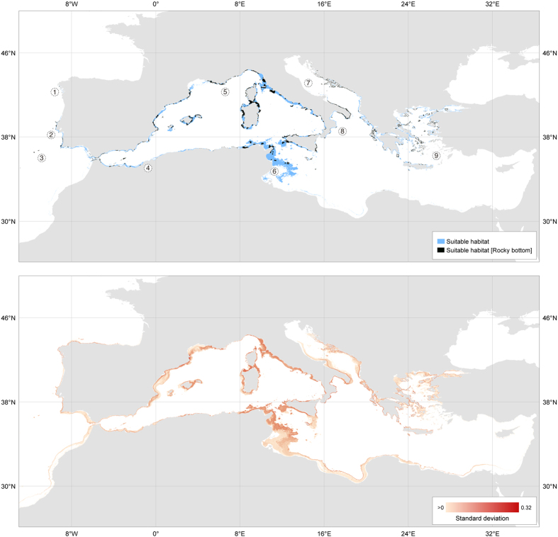
Figure 2. Predicted suitable habitat of Paramuricea clavata.
Top - The reclassified ensemble of potential habitat of P. clavata considering the environmental conditions only (blue) and its interception with rocky bottoms (black); Bottom - Prediction uncertainty (standard deviation) from ensemble modelling. Numbers refer to locations mentioned in the text: 1 - Northwest Iberia (Spain), 2 - West Portugal, including Berlengas islands, 3 - Gorringe Bank (seamounts), 4 - Alboran Sea, including islands and seamounts, 5 - Ligurian Sea, 6 - Gulf of Gabes, Tunisia, 7 -Adriatic Sea, 8 - Ionian Sea, 9 - Aegean Sea. Both images are available for download as GeoTIFF files in link provided in Supplementary Fig. S11. Maps were created with QGIS (www.qgis.org).

