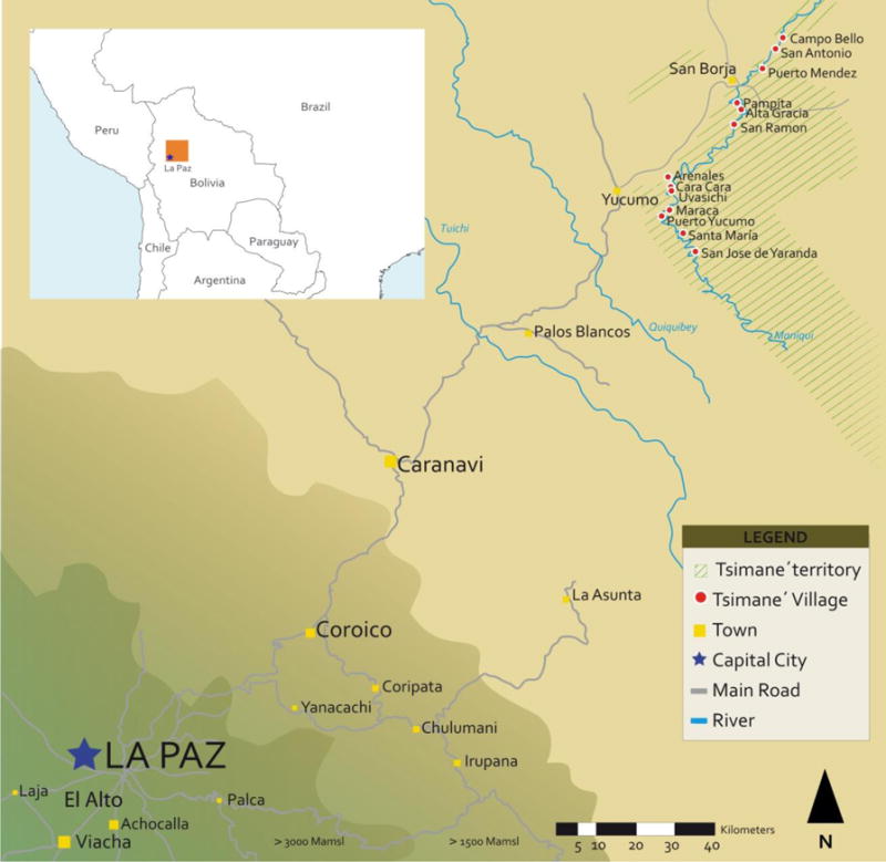
Figure 1. Map of the 13 Tsimane’ villages that participate in the annual panel study (2002–2010).

Note: The shading of the territory denotes elevation (mamsl=meters above sea level). The square symbols and letters in each town are approximately proportional in size to town population. Tsimane’ villages include the 13 villages of the annual (2002–2010) Tsimane’ Amazonian Panel Study (TAPS). The Tsimane’ territory is an administrative division that does not reflect all the lands inhabited by the Tsimane’.
