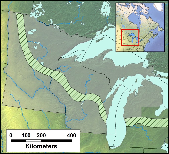
Fig 1. The domain of the Public Land Survey investigated in this study.
The broad domain includes Minnesota, Wisconsin and the upper two thirds of Michigan state (greyed cells). A 8x8km grid is superimposed over the region to aggregate data, resulting in a total of 7940 cells containing data. The striped band represents the Tension Zone [16], adapted across the region from Andersen [72].

