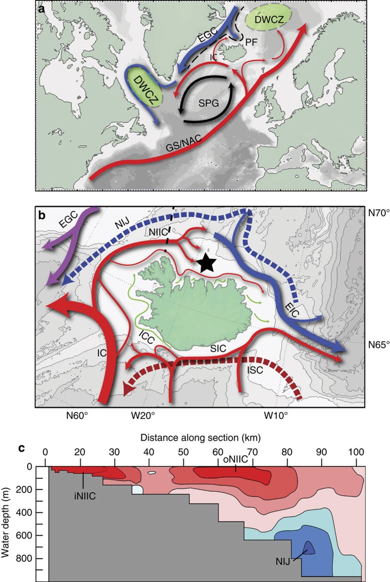
Figure 1. Maps of the modern surface currents of the North Atlantic and Icelandic shelf.
(a) North Atlantic circulation and (b) North Icelandic shelf circulation pattern. Arrows shown in blue correspond to cool and relatively fresh Arctic-sourced waters; arrows shown in red are warm and saline Atlantic-sourced waters; dashed lines correspond to deep currents whilst the solid arrows denote surface currents. The dashed black line in a refers to the approximate position of the North Atlantic Polar Front. The dashed black line in b refers to the depth transect shown in c. The star denotes the location of the shell sampling site (80 m water depth 66° 31.59′ N, 18° 11.74′ W). (c) Depth transect across the North Icelandic shelf indicating the direction of flow of each of three dominant water currents at this locality. Red colours indicate an easterly flow whilst blue indicates a westerly flow. DWCZ, deep water convection zones; EGC, East Greenland Current; EIC, East Icelandic Current; GS/NAC, Gulf Stream/North Atlantic Current; IC, Irminger Current; iNIIC, inner NIIC; ISC, Icelandic slope current; NIIC, North Icelandic Irminger Current; NIJ, North Icelandic Jet; oNIIC, outer NIIC; PF, polar front; SIC, South Icelandic Current. (b,c) Adapted from ref. 27 and the base map from ref. 43.

