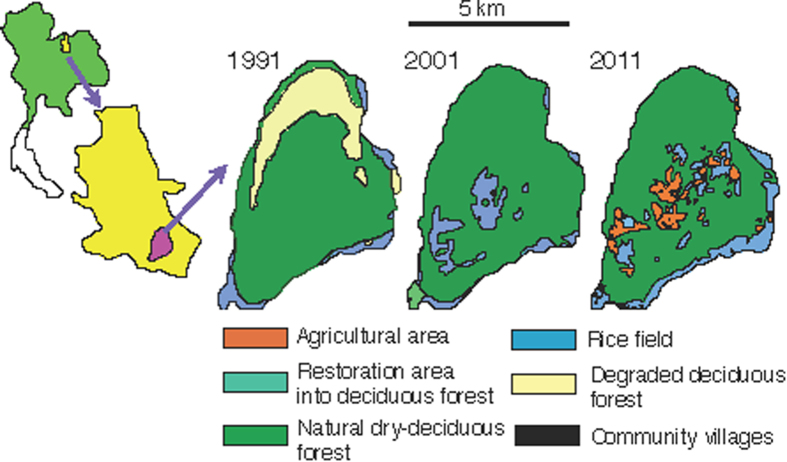
Figure 1. Temporal changes in land use in the Phu Koa (PK) area of Phu Kao–Phu Phan Kham National Park in Thailand.
The changes in land use in 1991, 2001 and 2011 (from right to left) over the last 20 years in the protected area included in the study site. The area of degraded forest in 1991 had almost recovered to forests with high vegetation cover by 2001. From 2001 to 2011, the areas of rice fields decreased, but the village and agricultural areas began to expand. We make the figures based on the digital maps of land use in the Land Development Department in Thailand.

