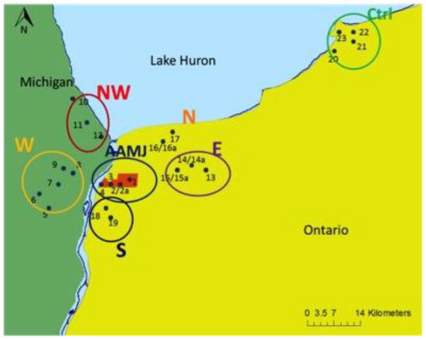
Figure 2.
Communities from which soil and sediment samples were collected. The Aamjiwnaang First Nation (AAMJ) is indicated in red (sampling sites 1–4), and sampled communities are located in each direction from the Reserve as indicated: NW: Port Huron, MI, situated north west of Aamjiwnaang; W: Marysville, MI, situated west; S: Corunna, Ont, situated to the south; N: northern Sarnia, Ont, situated north; E: eastern Sarnia, Ont, situated east; and Ctrl: Kettle Point, Ont, the control community. Maps and layer data provided by Geography Network Canada, Michigan Center for Geographic Information, and Great Lakes Information Network.

