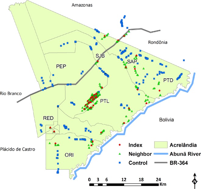
Fig 3. Spatial distribution of individual index, neighbor, and control households (HHs) included in the study.
HHs were distributed into seven localities of the municipality of Acrelândia (defined by the local malaria control program): Gleba Porto Luiz (PTL), Projeto Santo Antônio Peixoto (SAP), São João do Balanceio (SJB), Projeto Redenção (RED), Projeto Orion (ORI), Reserva Porto Dias (PTD), and Projeto Pedro Peixoto (PEP). Note that one index HH, five neighbor HHs, and 29 control HHs are situated outside the territory of Acrelândia (light green area), but still within the catchment area of local health services. The map also shows the nearest municipalities, Plácido de Castro and Rio Branco, the Abunã River, which delimits the border with Bolivia, and the BR 364 interstate highway, which connects the States of Acre, Rondônia, and southern Amazonas to the rest of the country.

