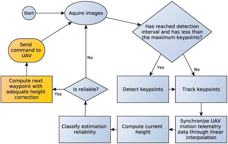
Figure 1.
Height estimation methodology. The system takes images as input and detects the Shi and Tomasi [14] keypoints at predefined intervals. Then, it tracks the keypoints through Lucas and Kanade [13] optical flow, takes the flow vectors and synchronizes the image information with the UAV telemetry data in order to compute the aircraft height. Finally, the system verifies if the estimation is accurate through a decision tree classification. The yellow boxes are further improvements currently being developed and are not part of this work.

