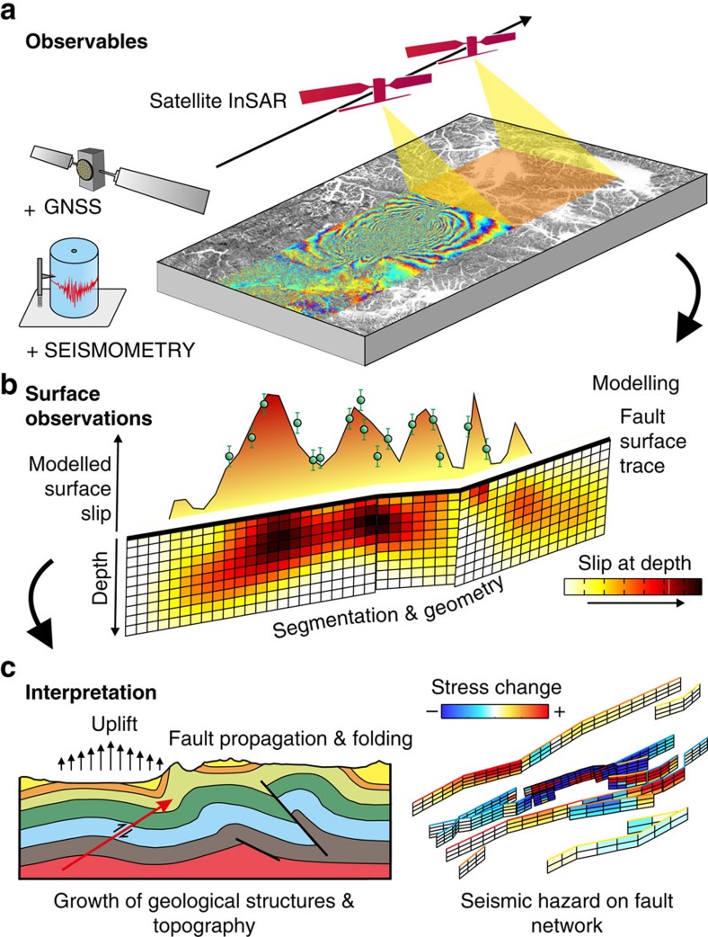
Figure 3. Work flow of observing and interpreting earthquake faulting and deformation using satellite data.
(a) Earth observations are used to model and interpret earthquake ruptures and the geometries of faults and their slip distributions. Satellite interferometry provides high-resolution measurements of surface displacements by repeated illumination of the ground with radar over wide areas. This captures in its entirety the ground motion due to some of the largest continental earthquakes7,8. These observations can also be augmented with complementary data sets such as GNSS and seismometry to provide a time history of rupture49,52. (b) Based on these data and using elastic dislocation theory, it is possible to infer the slip across the fault at depth, as well as constrain the geometry and segmentation of faulting41,42. The modelled observations of slip in the near-surface can then be compared with field observations of discrete mapped surface offsets (green circles). Determining the geometry of faulting and its relationship with surface geomorphology is important for interpreting the surface fault expression52 and understanding the segmentation of rupture20 for estimating potential seismic hazard. Establishing the extent of slip is needed for determining which portion of the fault failed in the earthquake, and also which did not and could fail in future8,41. (c) By establishing the depth range of faulting and combining this with geological mapping and sections, it is possible to constrain the relationship between faulting and the growth of geological structures such as folds119 and topography8, as well as explore the potential control of lithology on both coseismic119 and postseismic slip40. Using the distribution of slip and fault geometry, it is possible to infer the changes of stress on the surrounding network of faults in an attempt to update the estimate of seismic hazard in a region29,43,44. Portions of faults which have undergone an positive change in stress will an increased seismic hazard, whilst those with negative stress changes will have been brought away from failure.

