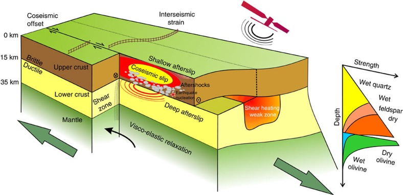
Figure 8. Conceptual cartoon of deformation in the crust and uppermost mantle.
Satellite geodesy offers the opportunity to measure the complete earthquake cycle: first, coseismic slip in the seismogenic upper crust, its relationship with aftershocks and fault segmentation; second, postseismic deformation localized on fault structures as shallow and deep afterslip, or more widely distributed through the ductile lower crust and upper mantle flow as viscoelastic relaxation; and third, interseismic strain accumulation across fault zones between earthquakes. By using the high spatial and temporal resolution of satellite observations, it will become possible to determine the time-dependent rates of deformation as well as the spatial extent of shear zones and weak zones beneath faults. Improved measurements of these processes in time and space will allow us to better constrain the lateral variability and depth-dependent rheology within the crust.

