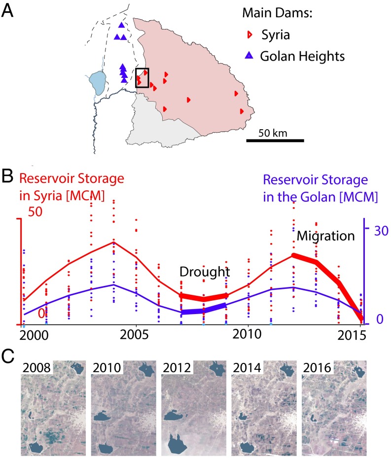
Fig. 3.
Remote sensing detection of reservoir storage. Time series estimates of water volume stored in the major reservoirs are presented for the Upper Yarmouk basin in Syria (A, red) and the Golan Heights (B, blue) (n = 189 for each region). Lines represent average annual storage, and monthly estimates are represented as dots. The effect of the 2006–2008 drought is visible for both regions as a local minimum in dammed-reservoir storage volume. A second decrease in reservoir storage was detected in both regions after 2012, but the decrease is significantly more dramatic in Syria, from which refugees fled. (C) Changes in reservoir storage are illustrated with satellite images of the westernmost reservoirs of southern Syria. The Landsat 7 images were taken at the end of the wet season (March and April) and are overlain by Normalized Difference Water Index water extent estimates (dark regions).

