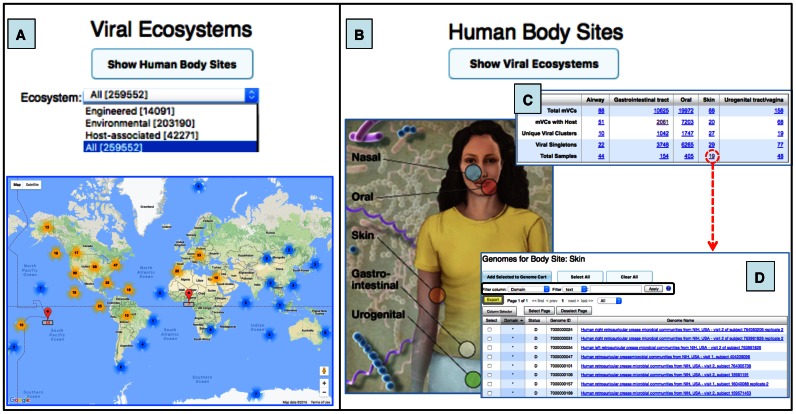
Figure 4.
Maps of samples containing viral contigs from environmental and human-associated metagenomes. (A) World interactive Google Map with a geographic location of metagenomic samples. All samples can be selected together or only those from any of the three major ecosystems. Map pins (in red) represent location counts of viral contigs and may contain multiple samples. Map pins are grouped into clusters and clusters themselves into larger clusters (bold number with a coloured halo based on number of members within the cluster) according to the Google Map javascript API utility library. As you zoom into any of the cluster locations, the number on the cluster decreases, and you begin to see the individual markers on the map. Zooming out of the map consolidates the markers into clusters again. (B) Human Body image showing the five body sites with available samples. All the metagenomic viral contigs identified in each body site can be accessed from the circles in the image. (C) Table provides information about mVC clusters/singletons, number of samples, and viral contigs with a host. (D) List of human skin samples with viral contigs. Columns can be sorted by clicking on the column header. Different filters can be used for specific searches (black box). This table can be exported by using the Export button (grey box with yellow background). Human body image credit: NIH Medical Arts and Printing.

