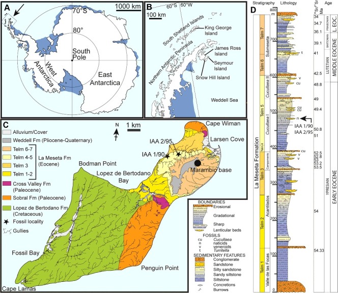
Figure 1.

Location and stratigraphy. A, map of Antarctica showing the position of the Antarctic Peninsula; B, map of the Antarctic Peninsula showing Seymour Island; C, geological map of Seymour Island showing the outcrop of Telm 4-5 and localities IAA 1/90 and 2/95; D, composite measured section through the La Meseta Formation showing the stratigraphical position of the sampled ‘Natica horizon’ (IAA 1/90 and 2/95). Modified from Reguero et al. (2013). Strontium date values from Dutton et al. (2002), Ivany et al. (2008), Dingle & Lavelle (1998) and Reguero et al. (2002).
