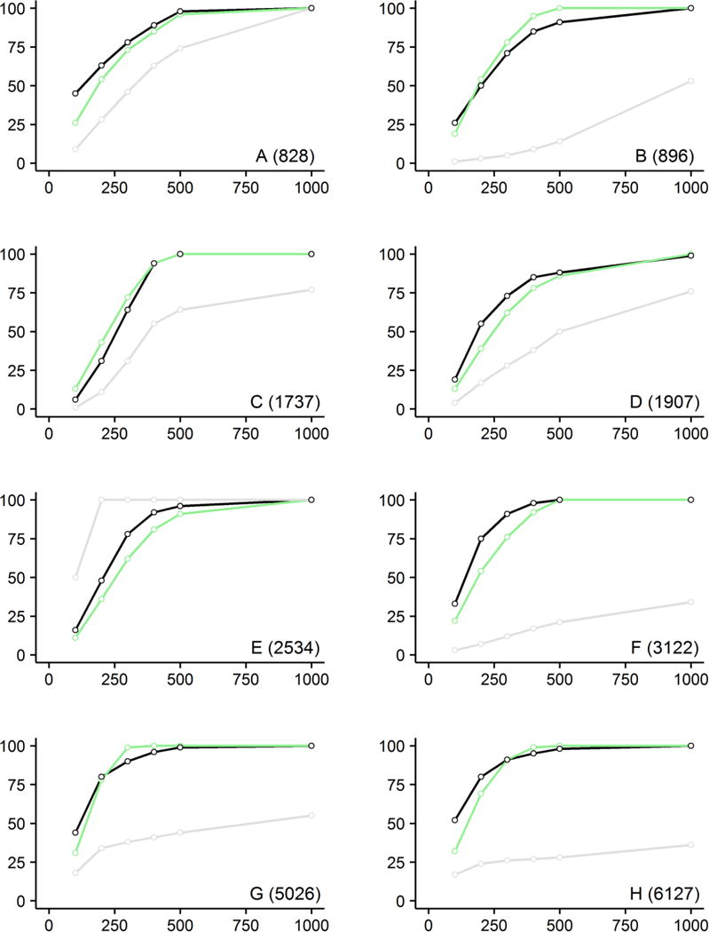
Figure 2.

Validation study of the spatial method using three population data sources: mapped households (black), Open Street Map polygons (green) and Worldpop raster data (gray); buffer distance (m) is displayed on the x-axis and Ifiws indicator value (%) on the y-axis; populations of case study towns A through H are noted in parentheses.
