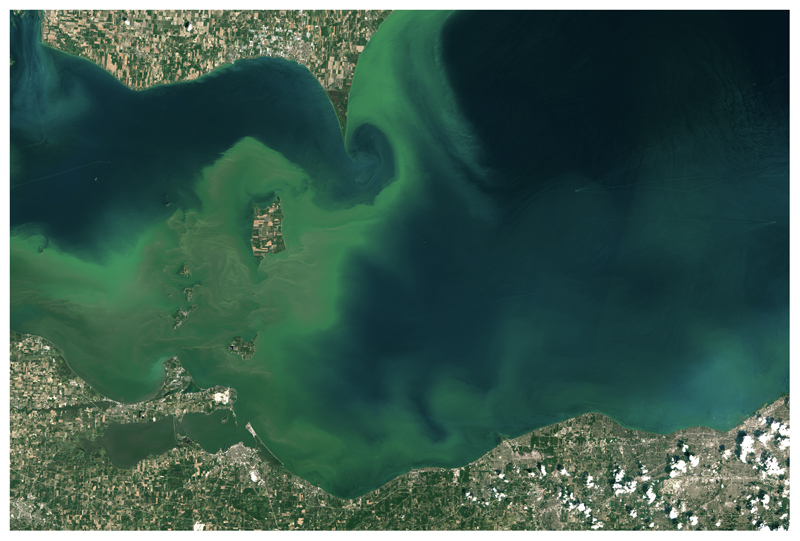
Figure 4.
Image of CHAB in west-central Lake Erie captured on July 28, 2015 by the Operational Land Imager (OLI) on Landsat 8. The CHAB enveloped the Lake Erie islands and continued into Canadian waters east of Point Pelee. The persistent CHAB in Sandusky Bay is also visible. Landsat imagery courtesy of NASA Goddard Space Flight Center and U.S. Geological Survey.

