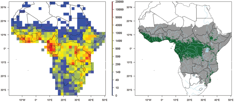
Figure 1.
Left map: record density in 2° × 2°cell including all georeferenced records that passed the quality checks. This map includes records that are identified or not to species level. Right map: main extent of RAINBIO geographical coverage from south of Sahel and north of Southern Africa (grey area); extent of tropical rain forest regions adapted from the land cover map published by Mayaux et al. (2004) (green area).

