
Fig 3. Spatial extent of krill fishing net hauls and raw ARGOS and GPS location estimates.
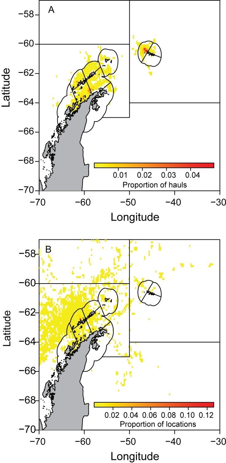
Data are binned to a 0.25° longitude x 0.125° latitude grid. Color scales represent the respective proportion of hauls and location estimates per grid cell.
Official websites use .gov
A
.gov website belongs to an official
government organization in the United States.
Secure .gov websites use HTTPS
A lock (
) or https:// means you've safely
connected to the .gov website. Share sensitive
information only on official, secure websites.
Data are binned to a 0.25° longitude x 0.125° latitude grid. Color scales represent the respective proportion of hauls and location estimates per grid cell.