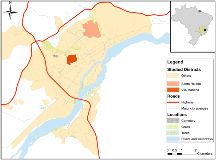
Figure 6. City map of Governador Valadares created using ArcGIS V.10.0.

The upper right inset shows the location of the Minas Gerais State in Brazil, the city of Governador Valadares (black circle) and the isolation site of the M2269 L. (L.) amazonensis reference in the State of Para (green circle). On the left, we show the neighborhoods where isolates S3 and S6 were collected in Governador Valadares (Vila Mariana and Santa Helena, respectively).
