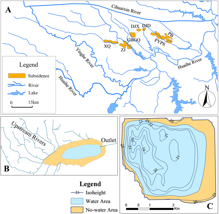
Figure 1.
Spatial distribution of the HCMS (A). The subsidence areas including XQ, ZJ, GBGQ, DJX, DJD, PYPS and PB, are distributed in a region surrounded by the Huaihe, Yinghe and Cihuaixin Rivers, which is taken as the study area for the water exchange simulation (area 4012 km2). (B) is a horizontal schematic diagram of an open subsidence area. (C) shows the ground surface isoheights and the water area on December 1st, 2009, in the GBGQ subsidence area, which is a closed subsidence area. Open and closed subsidence areas are explicated in Table 1. Maps were created using ArcGIS 9.3 (http://www.esri.com/software/arcgis/arcgis-for-desktop).

