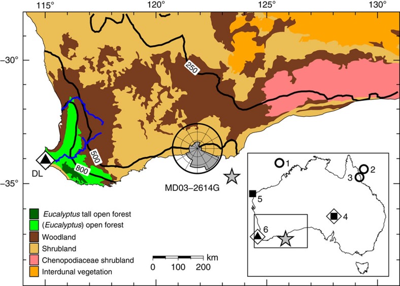
Figure 1. Map of south-western Australia showing location of core MD03-2614G (star) and archaeological and megafaunal site Devil's Lair (DL) discussed in text (triangle in open diamond).
Shown in addition are main present-day vegetation types derived from AUSLIG56, 250, 500 and 800 mm annual rainfall isohyets derived from CRU CL 2.0 (ref. 57), wind direction rose for the town of Esperance obtained from the Bureau of Meteorology and main rivers (blue lines). The insert map of Australia shows all sites mentioned in the text: the three long (≥150 kyr) continuous records of environmental change are denoted by open circles, other records of environmental change by squares, megafaunal sites by open diamonds and the triangle denotes archaeological site. Site numbers on inset map: (1) North Australian Basin (core MD98-2167); (2) Coral Sea (core ODP Site 820); (3) Lynch's Crater; (4) Lake Eyre; (5) Cape Range Peninsula (core Fr10/95-GC17); (6) Devil's Lair. Maps made using GMT58.

