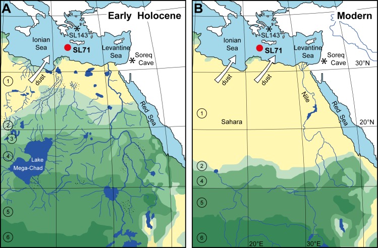
Fig 1. Location and North African vegetation and drainage changes between humid and arid phases.
(A) Simulated biome distribution (simplified after [4]) and North African drainage pattern (simplified after [11]; no data for the southwest part of the map) during the early Holocene humid phase. (B) Biome distribution at present-day (simplified after [4]). 1: hot desert; 2: warm grass/shrub; 3: temperate woods/shrub; 4: tropical bush/savannah; 5: tropical dry forest/savannah; 6: tropical forest. Stippled areas: alluvial fans. Red dot: position of the investigated sediment core M40/4_SL71 in the EMS; asterisks: positions of marine sediment core M51/3_SL143 and speleothem Soreq Cave mentioned in the text.

