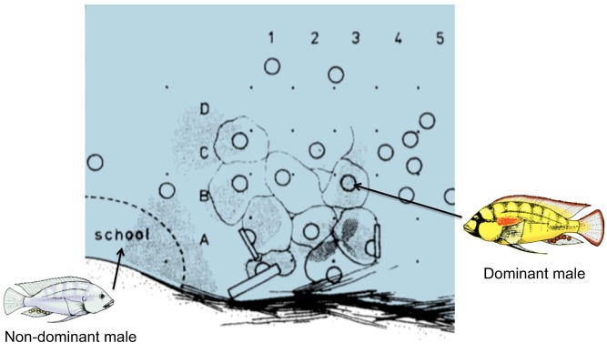
Fig. 1.
Sketch of an observation site along the edge of a shore pool on the north end of Lake Tanganyika, near Bujumbura, Burundi, Africa. Solid dots represent grid stakes spaced at ∼50 cm intervals that label grids (1–5; A–D) for identification. Circles represent spawning pit locations of dominant Astatotilapia burtoni males. Lighter outlines circumscribe the approximate territories of dominant individuals. Male territories are located over the food source of detritus on the bottom of the pool. This detritus accumulates at the northeast edge of pools as a result of the strong daily southerly winds. Non-dominant males and females school together near the territorial area that they have to enter to eat. Based on Fernald and Hirata (1977a).

