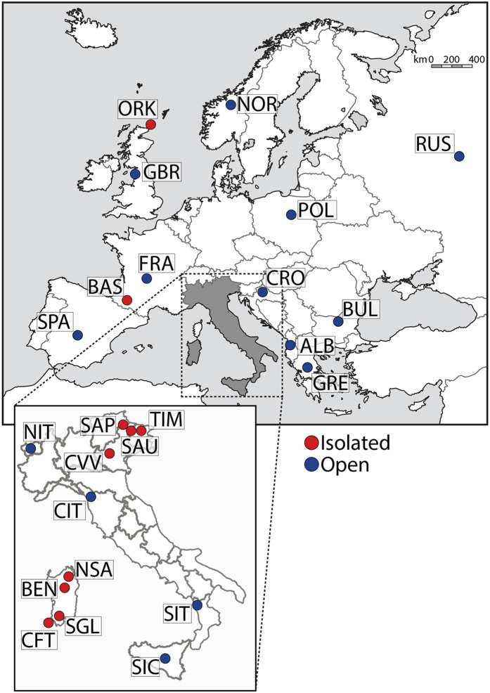
Figure 1. Map showing the geographic location of the 24 populations under study.
Labels as in Table 1. Maps available from Wikipedia Common web page (https://commons.wikimedia.org/wiki/File:Blank_political_map_Europe_in_2006_WF.svg?uselang=it#filelinks) were modified using Adobe Photoshop CS6 software.

