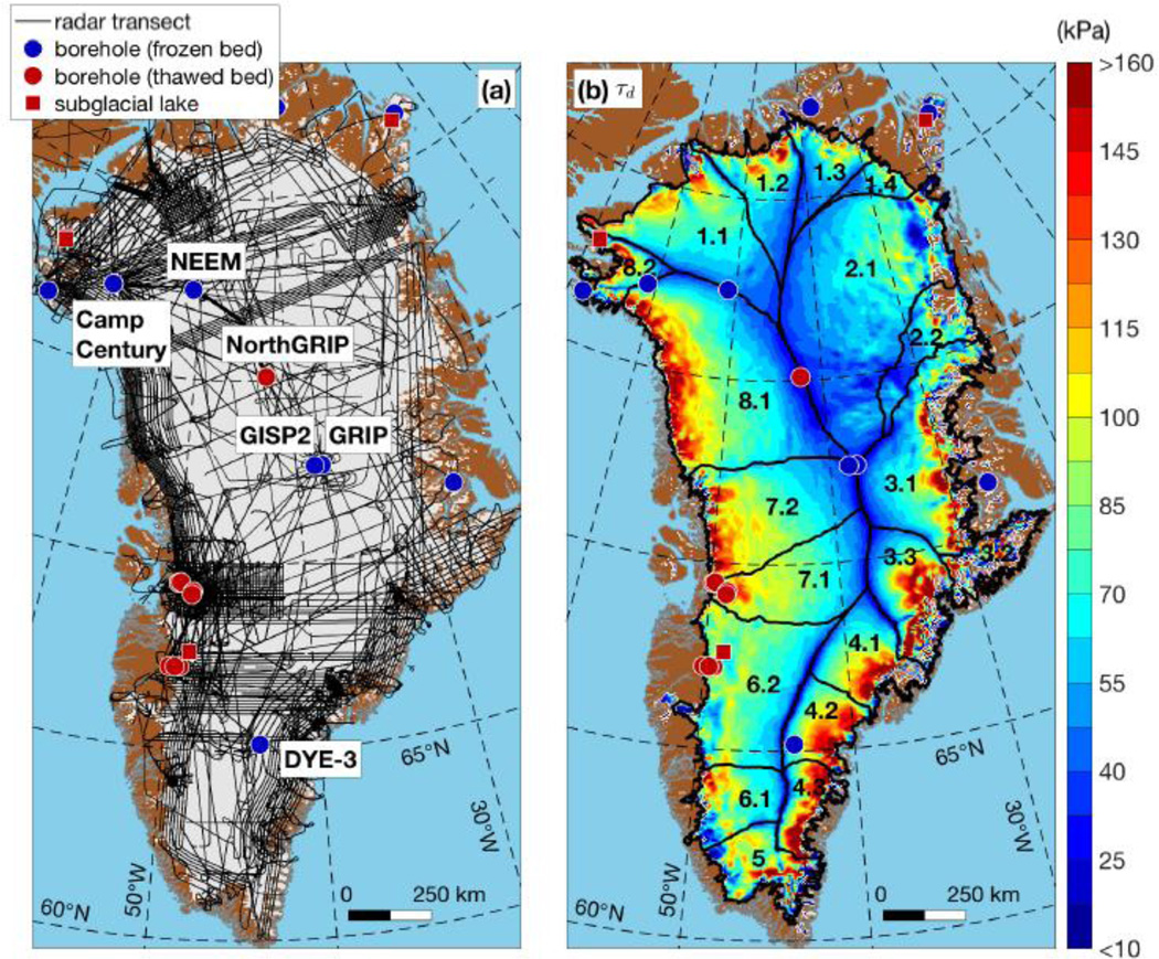
Figure 1.
(a) Map of Greenland showing the spatial coverage of 1993–2013 radar-sounding data used in this study (same as MacGregor et al. [2015a]), the basal thermal state of deep boreholes and the locations of known subglacial lakes. Table 1 lists the sources for the borehole data and subglacial lake locations. (b) Ice-drainage systems (IDS) of the GrIS, as delineated and labeled by Zwally et al. [2012], overlain on the driving stress τd.

