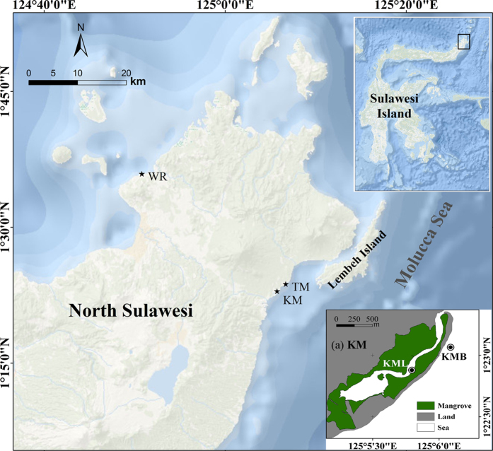
Figure 1. Locations of the four sampling sites in North Sulawesi, Indonesia.
The map was created with ArcGIS version 10.0 (https://www.arcgis.com) using the World Ocean Base freely available at http://services.arcgisonline.com/ArcGIS/services. The map of Kema area (a) was created with ArcGIS version 10.0 using the digitizing Google Earth (Version 7.1, https://www.google.com/earth/) image (Image ©2016 DigitalGlobe). WR: Wori; TM: Tanjung Merah; KM: Kema; KML: Kema lagoon; KMB: Kema beach.

