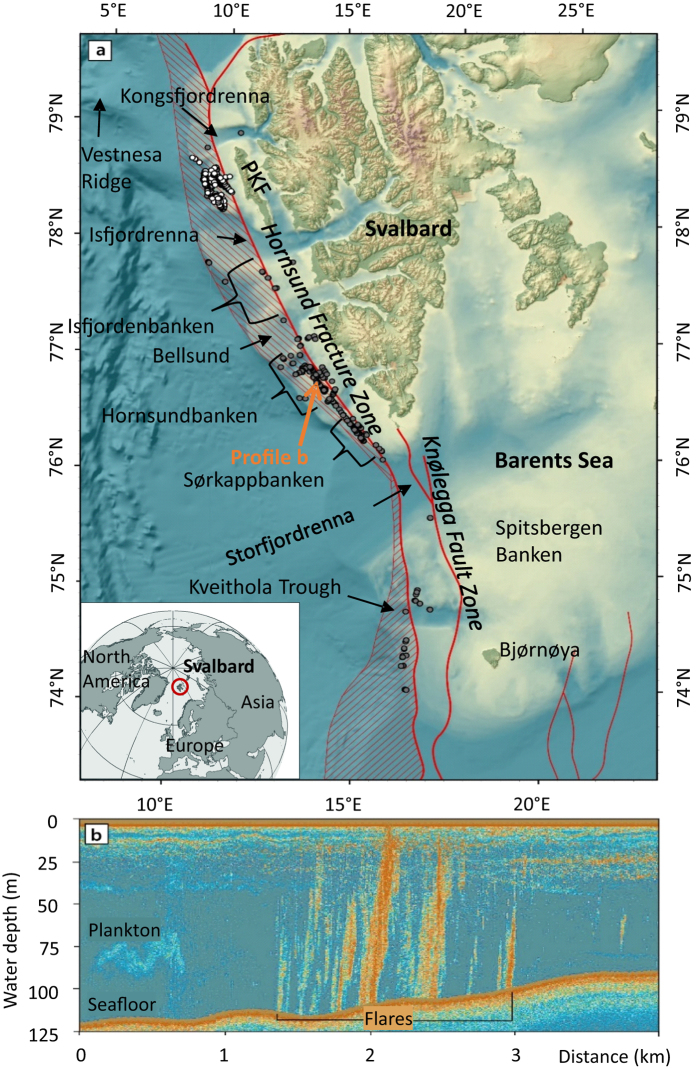
Figure 1. Flare locations along the Svalbard margin.
(a) Flares observed during HE449 and HE450 (gray dots) as well as flares described by Sahling et al.25 off Prins Karls Forland (PKF) (white dots). The map shows the main structural features in red according to Faleide et al.72; the striped fields indicate the stretched continental crust (stripes from left top to right bottom) and the Tertiary volcanic province (stripes from left bottom to right top). (b) Flares at Hornsundbanken reach the sea-surface (orange arrow marks the location in (a)). The map was generated using ArcGIS 10.2 (©ESRI).

