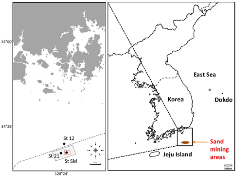
Figure 2.
Maps showing the sampling sites of seawaters and sediments from southern coastal waters of Korea. St. 21 (34°11.55′ N; 128°22.55′ E) and St. SM (34°11.17′ N; 128°24.50′ E) represent ‘sand mining’ site, and St. 12 (34°15.05′ N; 128°23.68′ E) ‘control’ site. The red square area on the left map represents the authorized on-going sand mining area (St SM). The grey area on the left map represents the marine sand research area for mining (St. 21). The dashed line indicates the Korean coastal waters up to 12 km from the main land.

