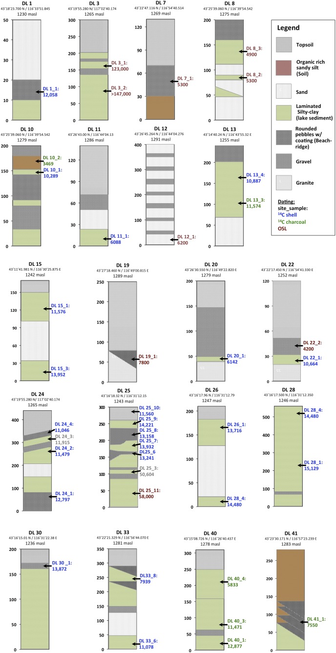
Fig. S2.
Lake Dali stratigraphic sections. The twenty sampling sites used to compile the Lake Dali lake-level curve. The figures depict the stratigraphy as seen in the section. Nonhorizontal contacts depict erosional unconformities. The site name, location, and elevation of each site is located above each section; the elevation refers to the top of the section. 14C dates (blue for shells and green for charcoal) and OSL (burgundy) are located at the sampling elevation and are positioned to the right of the section.

