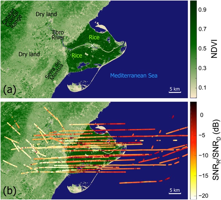
Figure 4.

Measurements over the Ebro River Delta: (a) NDVI derived from Landsat satellite data on 14 July 2005 when the sky was mostly clear and (b) ratio of the SNR of the reflected waveform to the SNR of the direct waveform along the flight lines conducted on 13 July 2005 during the Catalonia flight campaign in Spain. Over land, distinctively higher SNR values are observed over the rice fields (darkest green areas) as compared to the values around the town of Deltebre marked by the white cross and over dry land (lighter green area). The size of each point (0.5 km) in the figure corresponds to the median size of area covered by coherent reflections (see equation (1)), typically occurred over the inundated rice fields. The actual size will vary due to coherency, geometry, and 1 s incoherent summation of the data. However, the incoherent summation does not have large effect on resolution from airborne instrument because the specular point does not travel a long distance in 1 s.
