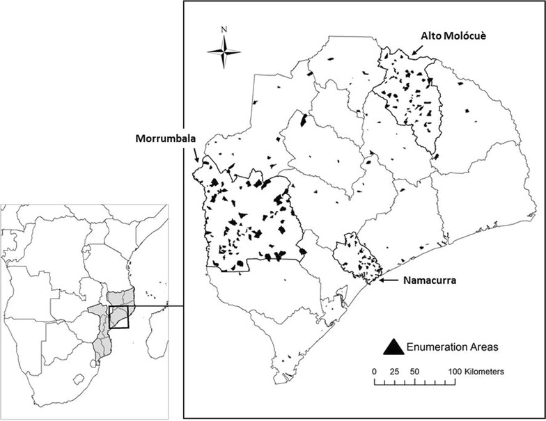
Fig. 1.

Map of Zambézia Province, Mozambique (right panel), as it is situated within Mozambique and Southern Africa (left panel). Borders of districts within the province are outlined, and the three oversampled focus districts (Alto Molócuè, Morrumbala, and Namacurra) are outlined in bold. Sampled enumeration areas are overlaid as black polygons.
Charlotte Buehler Cherry; Vanderbilt Institute for Global Health; Projection: WGS 1984 Web Mercator Auxiliary Sphere. Permission has been granted by the copy-right holder for publication of this figure in an open access journal
