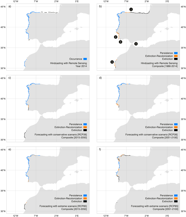
Figure 4. Distribution of Saccorhiza polyschides in Iberia-Morocco predicted with remote sensing data (period 1986–2014) and AOGCMs data (period 2015–2100, under two scenarios of greenhouse gas emissions.
RCP26 and RCP8.5). (Panel a) Predicted distribution in 2014 and sites (asterisks) where the species occurred in the past but our most recent surveys (years 2010 and 2012) failed to record it. Areas of persistence, extinction and extinction followed by recolonization for the periods (panel b) 1986–2014, (panels c,e) 2015–2050 and (panels d,f) 2051–2100. The reconstruction of distributions integrated a dispersal distance of 5 km and latency period of 2 years. Numbers represent Regions Of Interest: ROI 1: Cabo de Peñas; ROI 2: Carrapateira; ROI 3: Lagos; ROI 4: Tarifa; ROI 5: western Morocco. Maps generated with QGIS (QGIS Development Team, 2016. QGIS Geographic Information System. Open Source Geospatial Foundation Project. http://www.qgis.org/).

