
Figure 1. Map of South America with the locations of the records discussed in text.
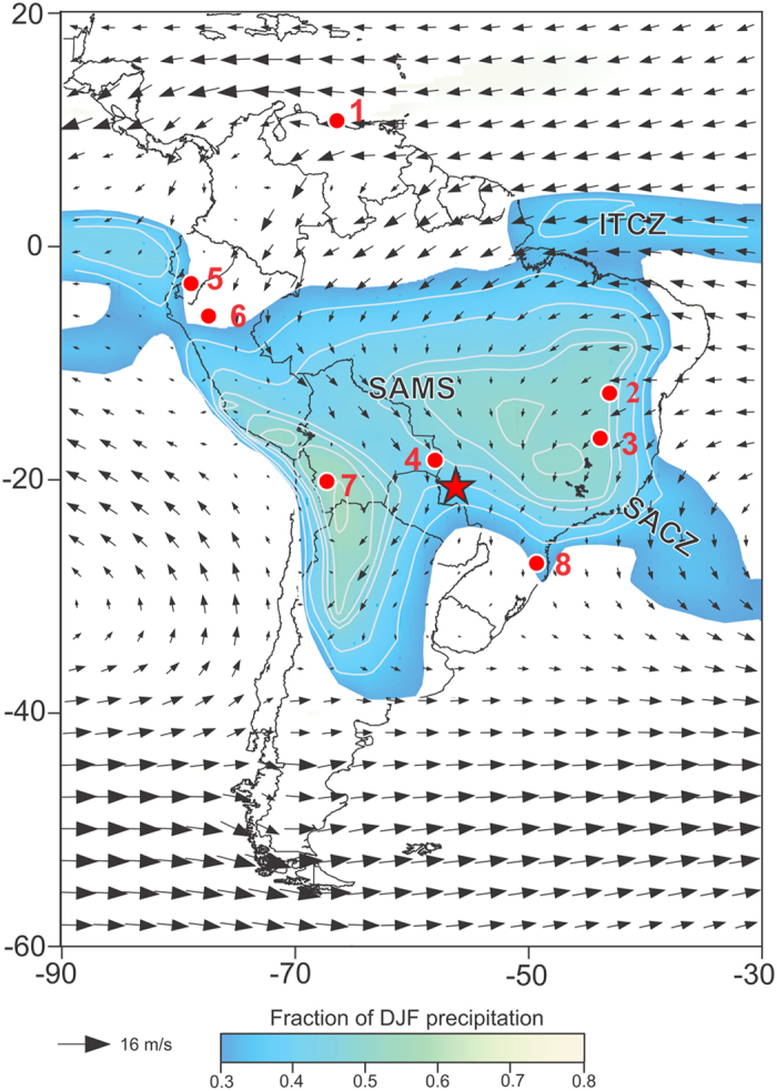
Austral summer (DJF) 850 hPa wind field and fractional DJF precipitation. Color shading indicates regions where fraction of total annual precipitation falling during austral summer (DJF) >0.3, highlighting the extent of the SAMS over the continent; contour interval is 0.05. Wind data is from ERA-Interim and precipitation data from GPCC, with averages calculated over period 1979–2014. Red star indicates the location of Jaraguá cave (our JAR record); 1- Cariaco Basin27; 2- Paixão cave7; 3- Lapa Sem Fim cave7; 4- Laguna La Gaiba15,23; 5- Santiago Cave4; 6- El Condor and Cueva del Diamante caves5; 7- Salar Uyuni1; 8- Botuverá Cave2. The figure was created using the software Adobe Illustrator CS6 version 16.0.0, in similar way as in Novello et al.18.