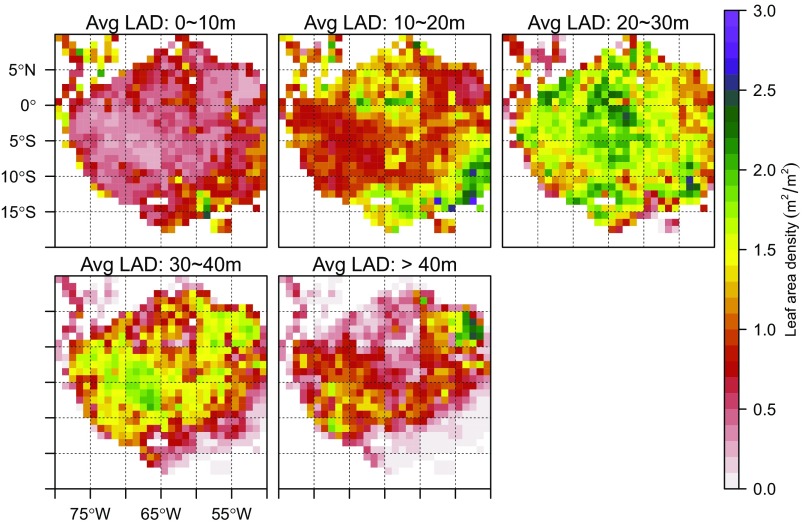
Fig. S7.
Spatial variation of vertical leaf area density (LAD) profile over Amazon forests at 1° pixels. The LAD is a vertical subset of total LAI, and is defined as the integrated lidar-observed leaf area between a certain height interval (e.g., 0–10 m), essentially giving the LAI in layers. The southeastern and northwestern Amazon have their highest LADs between 10 and 30 m in height, whereas southwestern and northeastern sections have foliage peaks higher in the canopy. LADs in the understory are generally small (<10% of total LAI) across most of Amazon forests.

