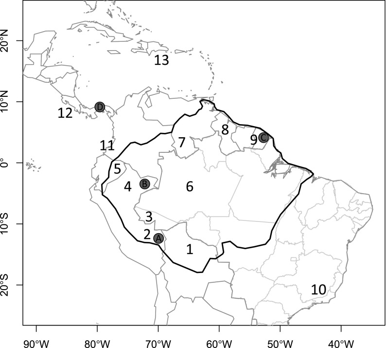
Fig. 1.
Map of the 13 neotropical regions used in the analyses of phylogenetic geographic structure for the four focal genera: 1, Amazonian Bolivia; 2, Madre de Dios, southern Peru; 3, Acre, Brazil; 4, Loreto, northern Peru; 5, Amazonian Ecuador; 6, Amazonas, Brazil; 7, Amazonas, Venezuela; 8, Guyana; 9, French Guiana; 10, Mata Atlantica (Atlantic rain forest); 11, Choco (trans-Andean) Colombia and Ecuador; 12, Central America, and 13, the Caribbean. Letters denote the location of the local communities of Inga (Leguminosae) that received in-depth sampling: A, Los Amigos Biological Station; B, Madreselva Biological Station; C, Nouragues Research Station; and D, Barro Colorado Island. The dark black line denotes our delimitation of Amazonia, which includes wet and moist forests across the Amazon basin and the Guianan Shield.

