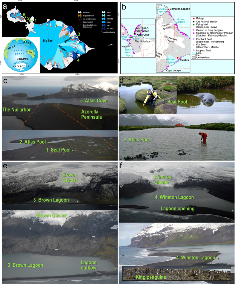
Figure 1. Heard Island sampling sites.
(a) Map showing change in glacier boundaries from pre 1947 to 2006–2009 (red outline), with sample collection sites numbered: 1, Seal Pool; 2, Atlas Pool; 3, Brown Lagoon; 4, Winston Lagoon; 5, Atlas Cove. Modified from a map courtesy of the Australian Antarctic Data Centre, CAASM metadata record ID Heard_Island_digitising_2009, map number 13691, © Commonwealth of Australia 2009. Inset: Depiction of Earth showing the isolation of Heard Island relative to surrounding continents with the closest being Antarctica (1,700 km to Davis Station), Australia (4,100 km to Perth) and Africa (4,800 to Johannesburg). Image courtesy of the Australian Geographic Cartographic Division. (b) Distribution of wildlife near the sample collection sites. Sections of a map courtesy of the Australian Antarctic Data Centre, map number 12583, © Commonwealth of Australia 2000. (c) Seal Pool (1) and Atlas Pool (2) on the Azorella Peninsula relative to the Atlas Cove (5) location where seawater was collected from the Aurora Australis (red ship). Photographer Gary Miller. (d) Sample collection at Seal Pool with elephant seal in Seal Pool prior to sampling, and Atlas Pool with Aurora Australis in the background. Photographers the Australian Antarctic Division and Rick Cavicchioli. (e) Aerial views of Brown Glacier above Brown Lagoon showing the rocky sill separating the lagoon from the ocean, and the lagoon outflow and approximate sampling sites. Photographer Gary Miller. (f) Aerial views of Winston Glacier and Winston Lagoon showing the glacier tongue in contact with the lagoon, and the opening of the lagoon permitting influx from the ocean, the approximate sampling site, and king penguins (inset) on the ocean-side shore of the lagoon at the time of sampling. Photographer Gary Miller and Stephen Brown.

