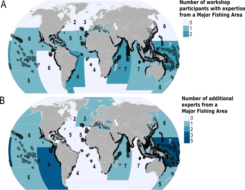
Figure 2. Geographic extent of the expertise that contributed to the Global Devil and Manta Ray Conservation Strategy.
Geographic extent of the expertise is shown using Food and Agriculture Major Fishing Areas (FAO MFA) and species Area of Occupancy (AOO) maps. The dark grey outlines around the countries indicate the presence of one or more mobulid AOO, and the number within each FAO MFA represents the number of species per major fishing area. The degree of colour saturation in each FAO MFA represents the number of experts (A) who attended the workshop, and (B) additional experts who shared information via electronic correspondence and/or from during the Fisheries Society of the British Isles symposium.

