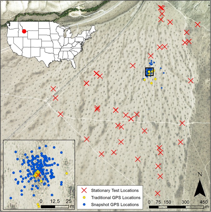
Fig 1. GPS data collection by GPS receivers at a stationary test location at Cedar Gulch.
GPS data collection by snapshot (blue circles) and traditional (yellow circles) at one stationary test location. Stationary test locations (red Xs) were distributed throughout the Cedar Gulch study site. Darker regions in the aerial imagery acquired from the National Agriculture Imagery Program (NAIP) display areas of denser shrub cover.

