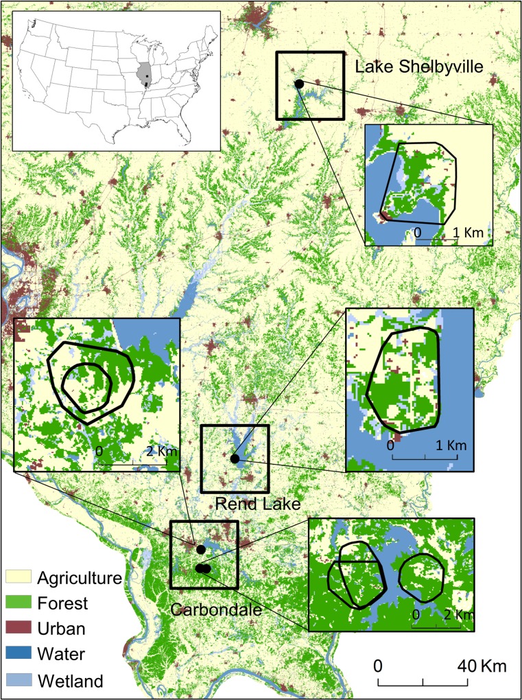
Fig 1. Five study areas (black dots) within 3 regions (black squares) in southern Illinois, USA.
Inset maps show minimum convex polygons (MCP) around the locations of all monitored female white-tailed deer (Odocoileus virginianus) for each study area during the gestation period (1 Jan– 10 Mar), as well as the location of Illinois (grey) within USA. Within the Carbondale region, the upper dot represents the Carbondale study area (inner and outer MCPs are Carbondale 2012 and 2005, respectively), the lower left dot represents the Touch of Nature study area (2012 and 2013 MCPs at Touch of Nature overlap), and the lower right dot represents the Crab Orchard study area. Land cover data are from the Illinois Natural History Survey Illinois Gap Analysis Land Cover Classification from 1999 and 2000 [33]. The forest category includes dry, mesic, and dry-mesic upland forest and mesic and wet-mesic floodplain forest. The agriculture category consists of soy, corn, rural grassland (permanent pastureland, roadsides and fence lines, railroad right-of-ways, waterways, prairies, and other grassland cover), winter wheat, and other small grains and hay. Water represents lakes and rivers, and wetlands includes both treed and untreed wetlands.

