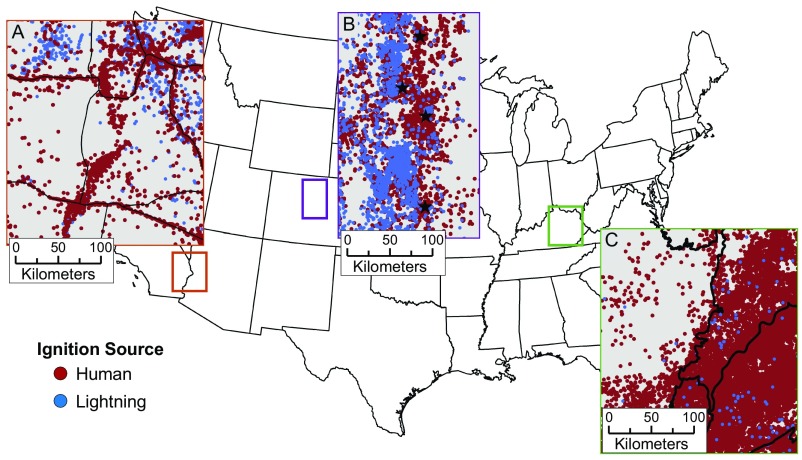
Fig. S5.
Visualization of how spatial patterns of human ignitions (red dots) vary across the United States. (A) In the southwest, human ignitions extend linearly along major highways (black lines) and into agricultural areas. (B) Urban development along the Colorado Front Range is a source of many fires in the wildland–urban interface. Stars indicate (from north) the cities of Fort Collins, Boulder, Denver, and Colorado Springs. (C) Human-caused fires increase substantially as ecosystems transition from the agriculture-dominated Interior Plateau in western Kentucky to Appalachian forest in eastern Kentucky (black lines are ecological region level III boundaries).

