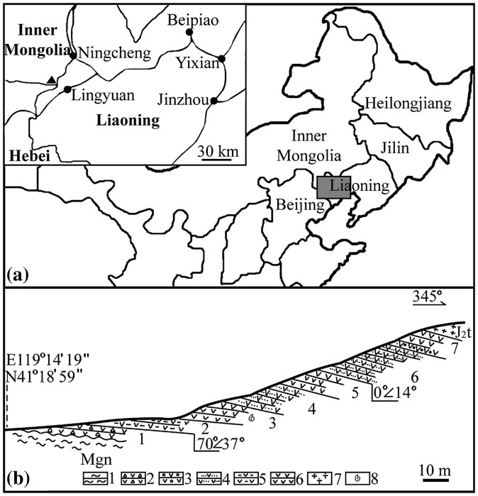
Figure 1.
Geological information of the fossil locality at Daohugou Village. Reproduced from Han et al. (2016). (a) Geographical position of Daohugou Village, Ningcheng, Inner Mongolia in China (119°14′40″E, 41°19′25″N). The rectangular region in the main map is shown in detail in the inset, in which the black triangle represents Daohugou Village and the black dots represent local cities, and (b) geological section of the Jiulongshan Formation near Daohugou Village. Layer 3 is the major fossil yielding layer. (1) gneiss; (2) tuffaceous grand conglomerate; (3) tuffaceous conglomerate; (4) tuffaceous siltstone; (5) tuffaceous mudstone; (6) tuffaceous shale; (7) volcanic breccia; and (8) fossil locality.

