Fig. 1.

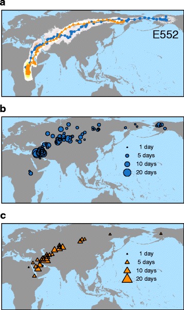
Migration route (a) and stopover sites in autumn (b) and spring (c). a Migration route of one northern wheatear from a breeding population in Alaska showing the mean daily location estimates (autumn: blue-filled circles; spring: orange-filled triangles) and the 95% CrI of these location estimates (autumn: pink; spring: yellow). Location estimates for breeding area (65.6° N, 145.4° W; 68.6° N, 149.6° W; U.S.A.) and wintering ground were removed. Furthermore, locations with 24 h daylight at high latitudes in spring are missing due to the dependency of the tracking method on sunrise and sunset times. Additional file 5 provides maps of all successfully tracked individuals. b, c Mean location estimates of stopovers for all birds tracked during autumn (b) and spring (c) migration. Individual size of symbols is proportional to duration of stopover
