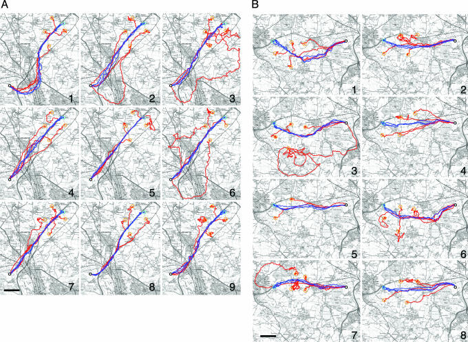
Fig. 1.
Flight tracks recorded from nine homing pigeons from a variety of release sites. (A) Shown are flights of individual subjects (birds 1–9) from Weston Wood and its vicinity. (B) Shown are flights by the same birds from High Cogges and its vicinity. Light blue circles indicate the location of the training release sites. Blue tracks correspond to subjects' final three training flights; red tracks show four subsequent off-route test releases (location of off-route sites marked by orange circles). Bird 9 failed to home on its second release from High Cogges and is thus missing from B; bird 5 disappeared after its second off-route test release from the High Cogges area. Location of home is indicated by a white dot. (Scale bars, 2 km.) [Map image copyright 2004, Crown Copyright Ordnance Survey, an EDINA Digimap/Joint Information Systems Committee (JISC) supplied service.]

