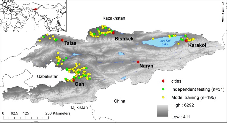
Figure 1.
Spatial setting of Kyrgyzstan in Central Asia (inset) and the spatial distribution of anthrax outbreak data to model the ecological distribution of Bacillus anthracis. All dots reflect the distribution of outbreaks in the country. Yellow dots represent the outbreak locations used to train the highest ranking model experiment in the study (experiment 8; Supplemental Table 1). Green dots represent data withheld to perform accuracy metrics on that experiment. Red stars represent major cities as landmarks to define anthrax foci in this study. The grayscale color ramp represents altitude in meters above sea level with higher elevations indicated in lighter shades.

