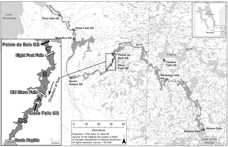
Fig 1. The Winnipeg River, from Lake of the Woods to Lake Winnipeg with hydroelectric generating stations marked.
The Slave Falls study area is inset, with sampling zones (C, B, A, DS) and known movement restrictors labelled in white. The names "Eight Foot Falls and Old Slave Falls" reflect pre-impoundment conditions. Basemap source data provided by Natural Resources Canada, reproduced in accordance with an Open Government Licence—Canada (http://open.canada.ca/en/open-government-licence-canada).

