
Fig. 1. Map of the study sites and atmospheric circulation pattern.
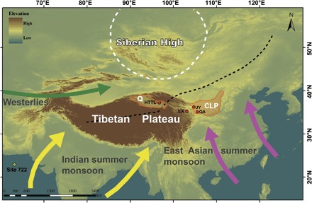
Black dashed line depicts the Asian summer monsoon fringes at present (84). The white dashed circle represents the Siberian High in January. HTTL, Huaitoutala; LX, Linxia; JY, Jingyuan; QA, Qinan; Q, Qaidam Basin; CLP, Chinese Loess Plateau.