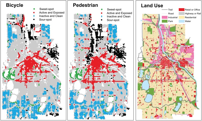
Figure 2.

Block type as defined in Table 2 for bicycle (left panel) and pedestrian (middle panel) traffic (right panel: land use pattern). Block types were classified if inclusion criteria were met for two of three pollutants; see Figures S1–S3 for individual pollutants. Underlying street and land use data are from Minnesota Geospatial Commons (https://gisdata.mn.gov/).
